GIS Levee Parcels Geodatabase
Managing Water Resources Through Database and Online Viewer Integration for State of California Department of Water Resources
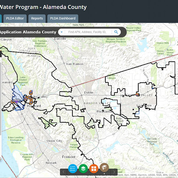
Psomas developed a GIS levee parcels geodatabase for California Department of Water Resources Enterprise GIS of the CVFPB levees consisting of 9,950 parcels and approximately 1,600 miles of levees in the State. The Psomas team, in coordination with DWR Geodetic GIS staff, developed an online project “viewer” containing aerial imagery and resource-grade parcel lines (including fee, easement, and joint-use agreement) that allows the client to have immediate access to land rights information throughout their jurisdiction on a parcel-by-parcel basis. The database which supports the secure ArcGIS online “viewer” was used to generate reports and track project status in real time. Psomas developed a robust training and QC process at each level to verify a quality product to DWR. This project included managing up to 30 staff across multiple offices, including two subconsultants working simultaneously on the project.
Services
- Geodatabase design with county parcel attribute information
- Resource-grade aerial imagery incorporation
- Immediate client data access through online viewer application
- GIS “hot map” of parcel data
CLIENT
State of California Department of Water Resources
LOCATION
Statewide, CA