Excavation U-Permit System Enhancement
Streamlining Utility Permit Tracking with GIS for City of Los Angeles
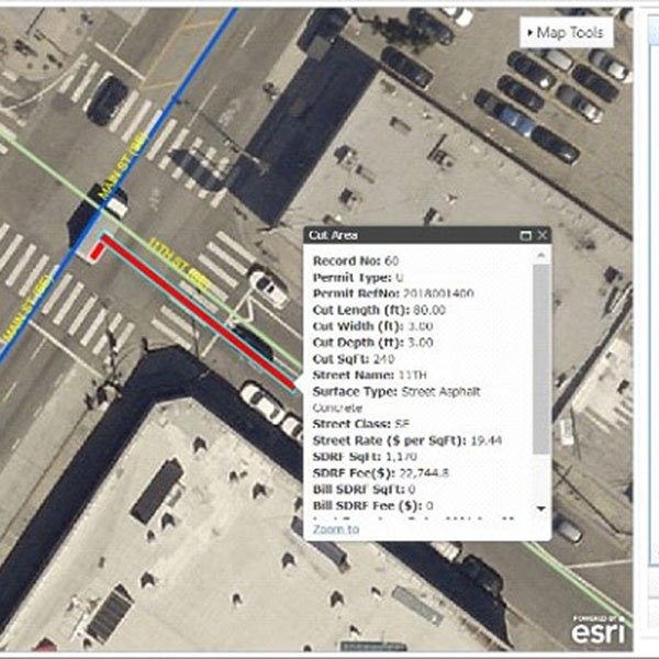
The City of Los Angeles BOE is the lead agency for all excavations permits issued for utilities within the public right-of-way. The City’s goal was a “cradle-to-grave” permits management system that allows customers, inspectors, and utilities, as well as City departments to easily track the status of permits, street damage, and for authorized users to update permit status.
The Enhanced Excavation U-Permit System reduces a significant amount of the manual verification and review/validation process while automating the workflow to the greatest extent possible. A key enhancement to the U-permit process was implementing an Esri GIS JavaScript-based interface to allow users to utilize online map tools to define precise street cut area for fee computation and to manage warranty tracking. This refined methodology facilitated the implementation of a revised City ordinance for street damage fees.
Services
- Simplified permit status tracking
- Centralized information sharing through connected enterprise systems
- Automated workflows and reduced manual verification
- Esri GIS JavaScript for user accessible map tools
CLIENT
City of Los Angeles
LOCATION
Los Angeles, CA