Geospatial Services
Groundbreaking Technology for a New Era of Surveying
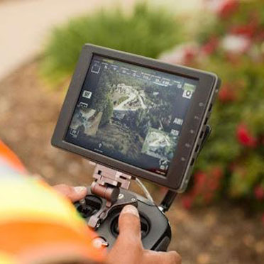
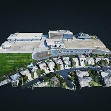
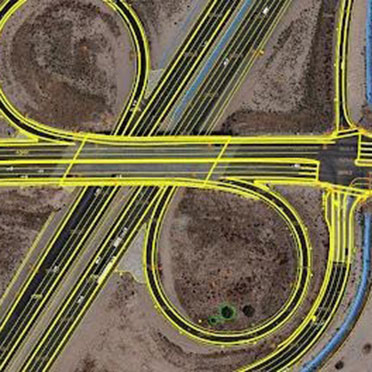
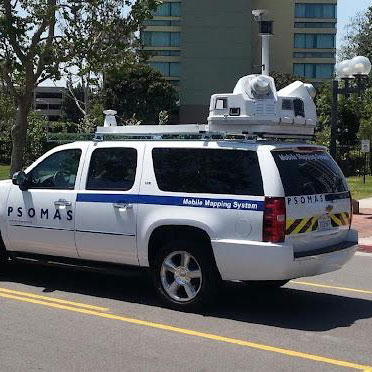
Psomas’ Geospatial Services department is taking traditional surveying techniques into a new era. Now with extensive geospatial capabilities, Psomas develops innovative models and maps, digital cities and more with cutting-edge precision. The latest technology — think drones, lasers, 3D scanning and more — allows us to acquire and transform complex project imagery, measurement and data into real-life solutions.
Geospatial technology is fast, it’s cost-effective and it produces the most accurate, high-quality and creative solutions our clients have ever seen.